使用者提供的地景
我們擁有所有七大洲(使用七大洲模型劃分)的地景,包含南極洲!
地景:
北美洲
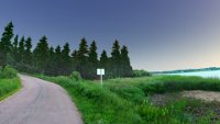 |
Grand-Barachois, New-Brunswick, Canada |
0.10+ |
| Pierre Bédard |
Public Domain |
English |
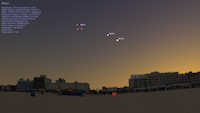
| Grand-Barachois (Facing the south of Prince-Edward-Island, near Cap-Pelé), New-Brunswick, Canada. This landscape was taken with a Fuji FinePix S2000-HD camera on 2011-07-16 at 21:02.
Among the most beautiful sunsets ever seen, and where people are of the most nice and welcoming. |
 |
Mount Wilson Observatory |
0.12+ |
| Florentin Millour |
N/A |
English |
| A view of the Mount Wilson Observatory, where the expansion of the Universe was discovered. The 60 inch telescope dome can be seen to the South-West, and one of the 6 CHARA array telescopes is visible to the East. |
 |
Walkway Over The Hudson, New York, USA |
0.11+ |
| Eric Myers |
CC BY-NC |
English |
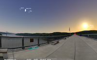
| Walkway Over The Hudson Historic State Park spans the Hudson river in the state of New York between Poughkeepsie and Highland.
It was originally a railroad bridge, which was completed in 1889 and was in service until 1974, when it was closed after a fire.
The bridge is 1.28 miles long, with the center deck 212 feet above the river (which is at sea level — the river actually flows both directions with the ocean tides far inland beyond Poughkeepsie).
The bridge was later refurbished into a pedestrian walkway, which opened in 2009, becoming the longest footbridge in the world. |
 |
United States Military Academy at West Point |
0.11+ |
| Eric Myers |
CC BY-NC |
English |
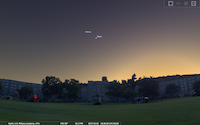
| The United States Military Academy at West Point, New York, was established in 1802, at a location originally used by the Continental Army during the American Revolutionary War. The photos used to assemble this landscape were taken from the parade field at West Point during Branch Week. Visible in front of Washington Hall one can see, among other things, two AH-64 Apache helicopters, two CH-47 Chinook helicopters, a Stryker armored fighting vehicle, and an M-1 Abrams Tank. |
| Screenshot not available |
Farrand Field, Boulder, Colorado, US |
0.9+ |
| Martin C. Doege |
GPLv2+ |
English |
| Panorama taken from Farrand Field at the University of Colorado at
Boulder. The Flatirons are visible to the southwest.
|
| Screenshot not available |
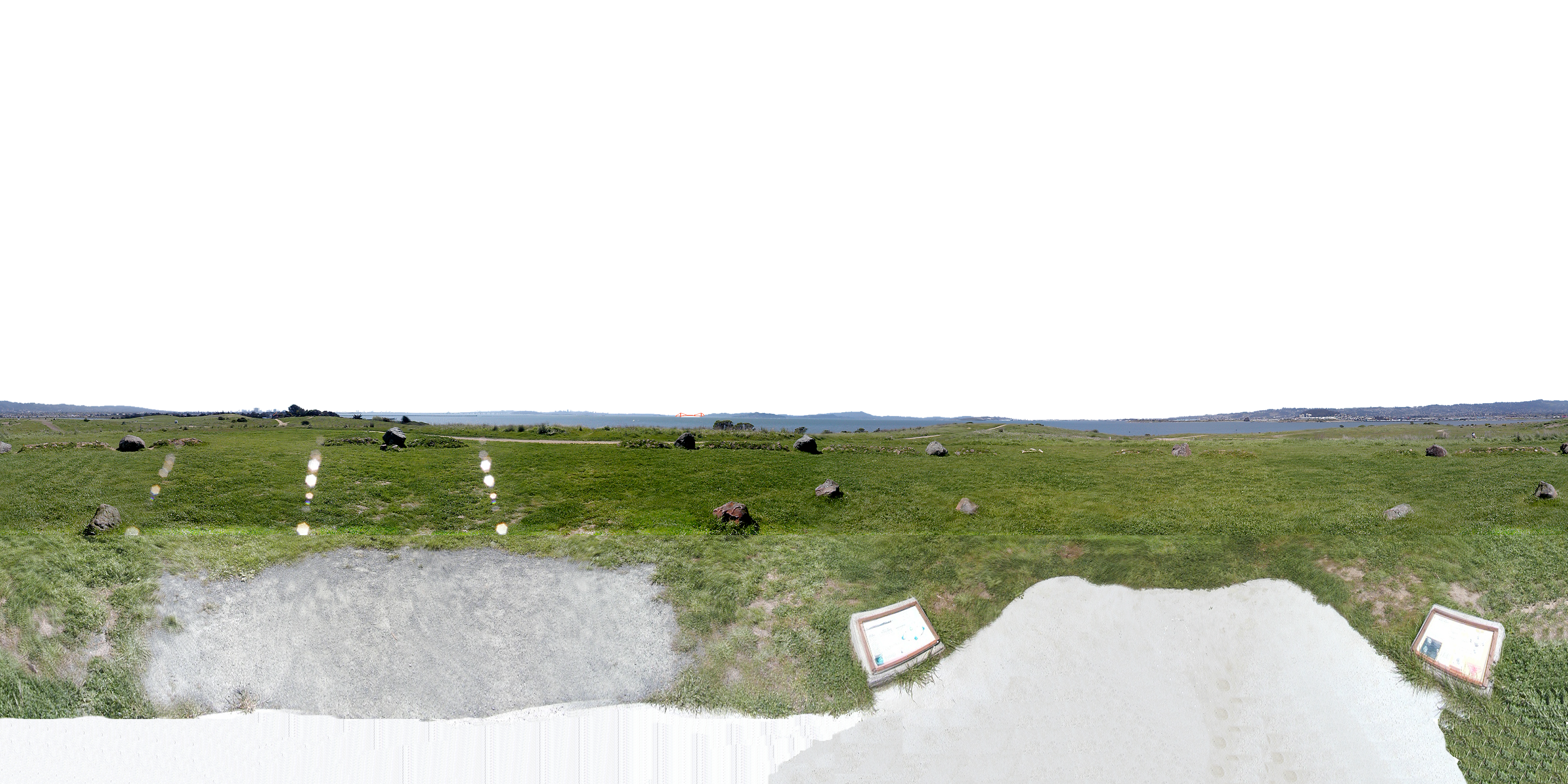
Cesar Chavez Memorial, Berkeley, CA, USA |
0.9+ |
| Lee Trampleasure Amosslee |
N/A |
English |
| This panorama is centered at the Cesar Chavez Memorial Solar Calendar
at the Berkeley Marina. The solar calendar has large stones that line
up with the sunrises and sunsets at the equinoxes and solstices.
The author painted the Golden Gate bridge to make it stand out a bit
more.
|
 |
Cherry Springs State Park |
0.12+ |
| Menefist |
Public Domain |
English |
| Cherry Springs State Park is a 82-acre (33 ha) Pennsylvania state park in Potter County, Pennsylvania. It is popular with astronomers and stargazers for having some of the darkest night skies on the east coast of the United States || LVM: 6.5 - 7.0 or best MPSAS: 21.82. |
 |
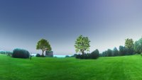
Chesterton Elementary School - San Diego, California, USA |
0.10+ |
| John Chester |
N/A |
English |
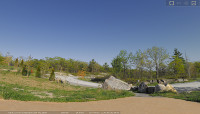
| This landscape was taken to help encourage students to learn about science and astronomy using Stellarium.
The panorama was taken at the playground area of Chesterton Elementary School on October 23, 2011.
The image was constructed using the Multiple Image Method using 8 overlapping images to provide a high level of detail.
The original composite panorama image was 22442 (width) x 2418 (height) pixels.
Composite photo reduced to 5 equally sized photos of 2048 by 1024 pixels.
Many trees created complex horizon background but left details, such as tether-ball poles, in place during transparency development to keep landscape realistic.
The lines of the playground provide an interesting perspective with Stellarium. |
 |
Heritage Park Museum, in Terrace, British Columbia, Canada |
0.9+ |
| Lenard Lindstrom |
CC BY-NC-ND 3.0 |
English |
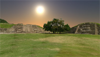
| A view of Heritage Park Museum, Terrace, British Columbia, Canada. It was photographed in August, 2011.
The full panorama, including sky, can be viewed at 360Cities.
This collection of early 20th Century log buildings shows the diverse construction styles used by immigrant settlers of the Skeena Valley.
The two story Kalum Lake Hotel is the centrepiece of the park. To the right of the hotel a summer student talks with two of the fifteen or so young visitors attending a children's day. |
 |
Ville de Percé, Québec, Canada |
0.10+ |
| Pierre Bédard |
Public Domain |
English |
| Ville de Percé, Québec, Qc, Canada. This landscape was taken with a Fuji FinePix S2000-HD camera on 2012-08-18 15:07. |
 |
Plaines d'Abraham, Québec, Canada |
0.10+ |
| Pierre Bédard |
Public Domain |
English |
| Plaines d'Abraham (Partie du Site historique des Champs de Bataille Nationaux), Québec, Qc, Canada. This landscape was taken with a Fuji FinePix S2000-HD camera on 2011.08.14. |
 |
Salt Lake City Panorama |
0.9+ |
| Hiram Bertoch |
N/A |
English |
| Hiram made this panorama for the KidsKnowIt Network's outreach program. |
| Screenshot not available |
San Jose, California, USA |
0.9+ |
| BrendaEM |
N/A |
English |
| This panorama was made using Nasa's WorldWind. Screenshots were taken at 45 degree increments. The screenshots were layered and stitched together, and then offset until the the Northern mountains were aligned. A landscape such as this could be made of any location in the world. There is a plug-in for WorldWind called "BigScreenshot," that may make the process easier, but not automate it. A plug-in could be written to do this entire process automatically. |
 |
Mount Shea in northern British Columbia, Canada |
N/A |
| Eddie Carle |
CC BY-SA 3.0 |
English |
| This is a panorama I took near the peak of Mount Shea in northern British Columbia, Canada. My goal was to create an ultra high resolution landscape of a very remote, illumination-free area of Canada. It is also a tone-mapped HDR. If you'd like to see other photos from the voyage, see http://alcazarmountain.com/shea |
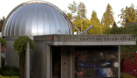 |
Trottier Observatory, SFU, British Columbia, Canada |
0.10+ |
| Bryon "PackPuppy" Elliott |
CC BY-SA 4.0 |
English |
| Simon Fraser University's beautiful Trottier Observatory & Science Courtyard in Burnaby, British Columbia, Canada!
It is jointly operated by SFU and the Vancouver branch of the Royal Astronomical Society of Canada.
Every clear Friday night, "Starry Nights" happens here, whereat anyone interested may drop by to peer through the observatory's telescope! |


