lanskap kontribusi pengguna
Kami memiliki lanskap untuk ke tujuh benua (pada model tujuh benua) - semuanya, termasuk dari Antartika
lanskap:
Australasia
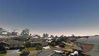 |
Beaumont Hills, Sydney, Australia |
0.9+ |
| Barry Gerdes |
GPLv2+ |
English |
| Barry made an interesting multiple-image landscape from the rooftop of his house. You can find a detailed account of how this was done in the Stellarium User Guide. |
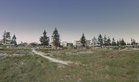 |
Largs Bay in South Australia |
0.9+ |
| Martin Lewicki |
GPL |
English |
| Panoramic view of Largs Bay in South Australia 8 panel old style landscape. Largs Pier Hotel facade in SSE and Largs Bay Sailing Club due east. Jetty extends to Gulf St Vincent to the west. |
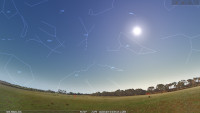 |
Meldanda, Australia |
0.10+ |
| Martin Lewicki |
N/A |
English |
| Meldanda is located in the River Murray International Dark Sky Reserve in South Australia. The Reserve was accredited by IDA in 2019. At 90km east of Adelaide [pop. 1 million] it is one of the darkest sites near a capital city with SQM readings above 21.9. [20 Aug 2020)
|
| Screenshot not available |
Penneshaw, Kangaroo Island, Australia |
0.9+ |
| Clive Nelson |
N/A |
English |
| Penneshaw is a small township at the Northwest end of Kangaroo Island, off the coast of South Australia. In the north is the entrance to Gulf St Vincent and the Australian mainland. In the east is the Penneshaw township, To the west, on the horizon, is Kingscote, the main town on Kangaroo Island. |
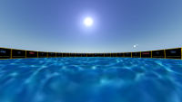 |
Hawaiian Star Compass |
0.12+ |
| Darren Kamalu, Nainoa Thompson |
N/A |
English |
| The star compass was developed by Nainoa Thompson of the Polynesian Voyaging Society after he was taught the principles of it by Master Navigator Mau Pialug of Satawal. |
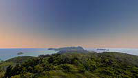 |
Transit Hill, Lord Howe Island, Australia |
0.9+ |
| Graeme Ewing |
N/A |
English |
| Graeme Ewing Contributed this panorama of the astronomically significant and visually stunning Transit Hill site Northeast of Sydney, Australia. |


